
SummaryWikipedia (en/ro)UNESCO Heritage Site
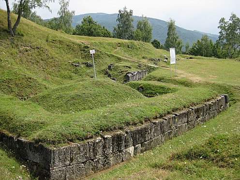

Costești-Cetățuie Dacian fortress
Costeşti-Cetăţuie was a Dacian fortified town. According to the UNESCO site: “Costeşti-Cetăţuie, a small plateau on a hill overlooking the left bank of the river Apa Oraşului, was terraced to form a strong fortress. Its fortifications were laid out in three concentric bands, erected in successive stages of the fortress’s life. The ramparts are constructed from stone, wood and rammed earth, a different technique being used for each enceinte. A number of towers survive.”
Coordinates: 45.680189°N 23.154285°E
Altitude: 514 m (1,686 ft)
Place name: Cetățuie
Town: Costești
County : Hunedoara
Country: Romania
Reference:
RO-LMI HD-I-s-A-03177 [1]
RO-RAN 90379.01
UNESCO 906
Http iframes are not shown in https pages in many major browsers. Please read this post for details.Virtual tour courtesy of http://muzeu.geomatic.ro/virtual_en.htm.
[mapsmarker marker=”76″]